Subscribe to our newsletter
Copyright © 2026 lmitac.com All Rights Reserved. Contact - Terms and Conditions - Privacy Policy - Quality Policy - Vacancies - Sitemap
London Maritime Academy is a trade name for London Premier Groupversion: 2.9.0
Subscribe to our newsletter

In an age dominated by advanced navigation systems and digital tools, the timeless art of traditional sea navigation remains a critical skill every seafarer should master. Long before modern technology, sailors relied on nature, stars, and deep environmental awareness to safely cross vast oceans. Today, understanding these fundamental techniques is not just a nod to maritime heritage—it is an essential backup that ensures safety, confidence, and precision when navigating the unpredictable conditions of the open sea.
Traditional sea navigation represents the ancient, non-instrument-based methods used by maritime cultures to cross vast, often treacherous oceans. Long before the invention of GPS, magnetic compasses, or modern sextants, early navigators—such as Polynesians, Vikings, Phoenicians, and Micronesians—relied on a profound, intimate knowledge of the natural environment and classical sea navigation techniques.
Understanding the marine environment, including currents, tides, and the position of islands, was essential for safe passage across the open Sea. Knowledge of local conditions allowed seafarers to compare routes and anticipate hazards efficiently. Environmental awareness was also critical for seafarers during long voyages.
This article reviews the basic aspects of Traditional Sea Navigation that every seafarer should know, as it stands as the backbone of safe seamanship, especially when screens go blank or when modern tools fail. Every journey, starting from a safe harbor, uses traditional knowledge and modern tools to search for the best route. Seafarers on fishing or transport ships must know how to navigate safely, as accidents in the middle of the ocean can occur easily without proper preparation.
Traditional Sea Navigation was an art of wayfinding, relying on memory, nature, and celestial cues rather than modern technology. Ancient mariners, from Polynesians to Phoenicians, mapped routes using stars, wind patterns, oceanographic currents, and seabird movements to navigate across vast seas and the open Sea. Instead of paper, Polynesians used stick charts to represent swell patterns and island locations. Historic routes, such as the Maritime Silk Road connecting China to Africa and the Mediterranean, were documented in early portolan charts that meticulously detailed coastlines, harbors, and other critical details. This deep knowledge allowed ancestors to travel thousands of miles confidently, leaving a legacy of remarkable maritime skill and enduring sea navigation traditions.
Modern sailors and navigators now rely on marine traffic websites like MarineTraffic or mobile App platforms to track ships and even large cruise vessels efficiently. Knowledge of local ports, east-bound currents, and weather patterns, including tropical cyclones, ensures safe passage. Safe docking at a terminal requires both technical knowledge and careful observation of marine conditions.
Ancient Seafarers used three main types of Traditional Sea Navigation:
Coastal Navigation Fundamentals involve Navigating in coastal waters by identifying landmarks and using visual bearings and landmarks to confirm location.
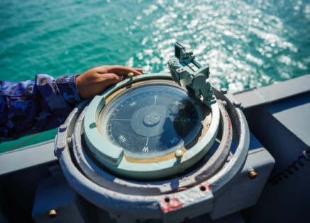
Navigators used instruments like the sextant or cross-staff to measure the angle between the horizon and the sun or stars to calculate latitude, particularly the North Star (Polaris) in the Northern Hemisphere. This technique remains crucial for navigator training.
This was essential when out of sight of land. It involves estimating the current position by calculating distance and direction traveled from a last known location, factoring in speed (often measured in "knots") and time, a core component of sea navigation skill.
Modern techniques also allow crews to search for hazards or track storms like tropical cyclones to avoid danger. Anti-collision systems and anti-piracy measures are now standard on royal and commercial ships, including large marine vessels.
These steps remain fundamental in sea navigation, even today, and are supported by science to improve precision and efficiency. Modern navigators rely on boating tools and satellite data to supplement their traditional knowledge and enhance marine awareness.
There is a saying: "Good tools are half the work," and it is obvious that skills are the other half. It is not enough to have tools, but one must master their use. At LMA, we sharpen your skills through our Maritime Safety training courses in London, supporting the global maritime community.
Each seafarer had to be an expert in the surrounding environment as well, such as recognizing cloud formations to predict the weather, being proficient in monitoring atmospheric pressure using a barometer to predict approaching storms, monitoring winds and reading tide data and charts to determine water depth and the strength and direction of ocean currents, in addition to understanding the consistent current patterns to calculate the difference between the intended and actual track—an essential part of sea navigation mastery.
Seafarers must also know how to avoid dangerous areas during storms, including cyclones, and arrive safely at their destination. Submarine threats or warfare hazards in international waters require that ships operate with the utmost security. Understanding how force and currents interact is crucial for maintaining control over marine operations.
For Basic Seamanship skills, a seafarer must be familiar with the rules of COLREGs (Rules of the Road). These rules mandate maintaining close observation, navigating at safe speeds, knowing which vessel has the right of way in passing, overtaking, or head-on encounters, and, of course, recognizing proper lights, shapes, and sound signals. Knowledge of fishing grounds, safe air circulation on deck, and keeping a door to critical compartments secure is vital for safety on all ships.
A seafarer must also master knot-tying such as bowline, clove hitch, and reef knot for securing gear and vessel handling, as well as being skillful in boxing the compass, having great spatial awareness, quick reflexes, and all the other skills required by this demanding profession. Efficient management of marine tasks allows sailing to be executed efficiently even in challenging seas. Knowledge of east-bound currents, tropical storms, and local weather patterns is vital for safe voyages.
When emergency situations arise, seafarers must show special skills like marking the position and conducting a rescue in the case of Man Overboard (MOB), distress signaling, and using life rafts and survival gear when abandoning a ship. Learning to act quickly and move through a door to safety can save lives easily.
In essence, modern technology is incredible, but true seamanship lies in mastering the essentials that have guided sailors for centuries. Traditional Sea Navigation isn't just backup; it's situational awareness, a crucial aspect of sea navigation for any serious seafarer. It also provides ongoing support in emergencies and ensures crews can adapt to the middle of the ocean with confidence.
Learning marine science, oceanographic patterns, and the dynamics of nations’ waters ensures safer ships, vessels, and crew, including those operating across united international waters.
LMA isn't just about top-notch modern topics. Our LMA Courses cover basics as well. We offer you a wide range of specialized professional content prepared by our leading experts. You can request to design any course of your interests as well.
And remember: in the moment of truth, LMA is always by your side, whether in London, Dubai, Istanbul, Athens, Amsterdam, Barcelona, Singapore, and Kuala Lumpur—or even Online!


